The Mine Wood was formerly owned by the Westerton Estate and was purchased by Bridge of Allan Burgh Council to commemorate the coronation of Queen Elizabeth II. The network of paths which run through the wood were laid out in the mid 19th Century by Sir James Alexander of Westerton and built by local unemployed labourers. The paths were restored under a Job Creation scheme in 1982 and have recently been improved.
There are many Broadleafs including Wych Elm, Oak, Beech, Birch and Sycamore. The Conifers include Larch, Scots Pine, Spruce, Douglas Fir and Western Hemlock. You can see wood pigeons, chaffinches, jays, wood-peckers, rabbits and grey squirrels. If you are lucky, you might spot roe deer.
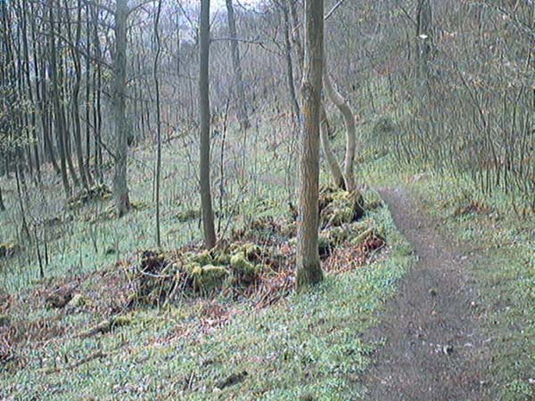
At the intersection of Sunnylaw Road and Abercromby Drive (A), you will see the signpost for COPPERMINE PATH DRUMBRAE. Climb the steps into the woods and follow the footpath as it winds its way up the hill through dense undergrowth and trees.
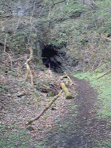
When you come to a clearing where a wooden seat sits on the edge of the hill (B). Take the short path which goes up to the left and you will see the entrance to the mine. This long, disused coppermine was worked intermittently since the 16th Century and at one time, copper from the mine was used in the mint at Stirling Castle.
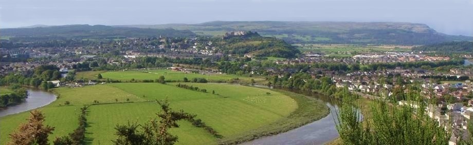
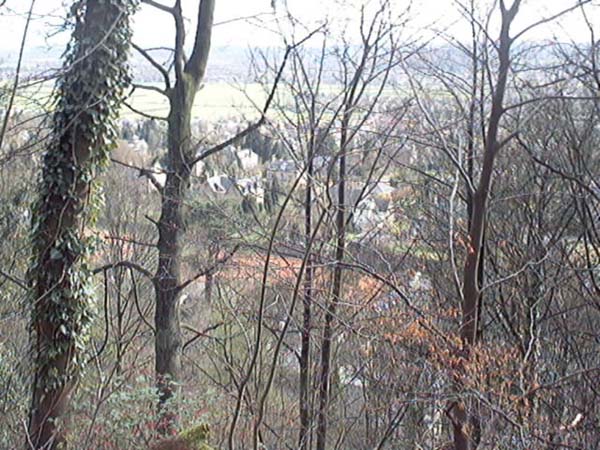
The path climbs up to Pendreich Road (C). By looking back through the trees, you will get elevated views over Stirling, Bridge of Allan, the Carse and the hills beyond.
If you want to go on further, walk along Pendreich Road past the golf course and on the right (D), you will find a footpath over the Black Hill to the Cocksburn Reservoir and Dumyat.
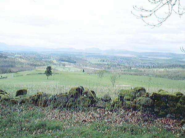
Walk a few steps further to the back of the golf course and make your way along the path by the dry-stone dyke. From here, you will get panoramic views to the North over Dunblane.
There are many paths through the woods which you can explore. The route we have chosen, is to follow the edge of the golf course all the way down. Eventually you will see the end of the woods and the rooftops of the houses on Glen Road ahead of you (E).
Proceed carefully down the hill and find one of the paths which will take you into the disused and overgrown Wolf's Hole Quarry (F).
Leave the quarry through the clearing, to Sunnylaw Road. Turn left and follow the terraced path back to the start of the walk.
Parking, buses, train station and local services in the town of Bridge of Allan
Click on the images below to see larger pictures of Bridge of Allan Mine Wood
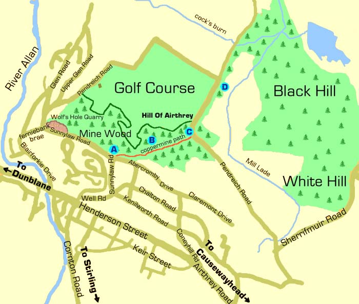
A At the intersection of Sunnylaw Road and Abercromby Drive, you will see a signpost for COPPERMINE PATH DRUMBRAE.
B Eventually the path leads to a clearing and you will see a wooden seat on the edge of the hill. Go up to the left and you will see the entrance to the disused mine.
C The footpath brings you out on the Pendreich Road. Come back down on one of the many paths through the woods or come across the golf course.
D On The Pendreich Road you will find a path which will take you around the Cocksburn Reservoir and to a lay-by on the Sherrifmuir Road where you can access Dumyat.
E Follow the dry stone dyke along the border of the golf course. Make your way down when you can see the end of the woods and the rooftops beyond.
F Find one of the paths into the disused and overgrown quarry then, return along Sunnylaw Road to the start of the walk.
