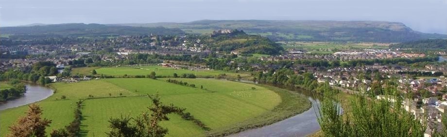
Alva is a small Clackmannanshire town, situated beneath the Ochil Hills. It is located between Tillicoultry and Menstrie and is one of the small chain of settlements, collectively referred to as the Hillfoots Villages or simply The Hillfoots. The Alva glen walk in the Ochil hills detailed on this page, is a scenic and dramatic Walk, only 8.5 miles from Stirling. Take it at your own pace. Great for a day out or even for a brisk couple of hours.
By 1830, nine mills used the fast flowing water of Alva Burn to drive their machines. Dams and lades were built to ensure that there was enough water throughout the year.
From the car park near the Longbank Works make your way into Macarthur Braes. Follow the path to the Glen, crossing the bridge and turning left to arrive at a view point for the dam. Follow the steps up to the left and go under a large, metal pipe which crosses over the path.The distance to Smugglers Cave is 1.5km, at a height of 200m. It should take around 45 minutes to get there. Allow 30 minutes to return.
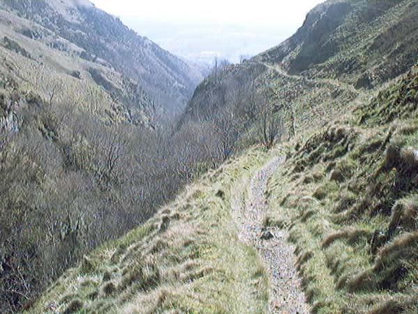
The path up to Alva Dam is easy to follow as it twists and turns through the mossy rocks and dense foliage of the Glen. The path is not suitable for people using wheelchairs or buggies.
From Alva Dam to Smugglers Cave, walk in single file as you follow the path which snakes up the hill. There are breathtaking views down the Glen but keep a close eye on children and dogs as the path is narrow and right on the edge of the cliffs.
From Smuggler's Cave, another quarter of a mile will take you to the Spout of Craighorn. From here, you could come back the way you came or return along the Pate Road. This walk should take about 2 hours to complete. Footpaths are reasonably good but can be slippery after wet weather. Children should be supervised at all times to ensure their safety - particularly on the first section of the Glen and the grassy slopes of Torry hill.
Try not to send any loose stones tumbling down the hill.
The long tailed Grey Wagtail can be seen in the Glen all year round and Kestrels are often spotted up in the rocky cliffs. Small roe deer may be seen at quiet times. Butterflies such as the Common Blue are in abundance.
Visit the Alva Glen Website, home of the Alva Glen Heritage Trust, a voluntary organisation and charity aiming to develop community spirit by restoring and regenerating Alva Glen.
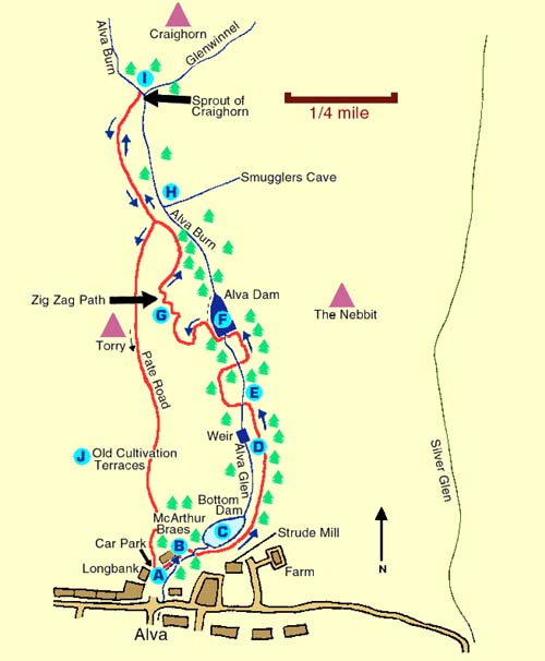
Map © The Forth Naturalist and Historian and Clackmannanshire Field Studies Society
Key to Map
A Dating from the 1880's, the Long Bank Works was one of the area's textile mills which was powered by the Alva Burn.
B McArthur Braes was created as a work project during the 1924 Depression.
C Follow the path to the Glen, cross the bridge and turn left to arrive at a view point for the falls and dam.
D Continue up the path among the trees of the steep sided Glen to the Weir.
E The Ladies Well and a bridge over deep rocky pools.
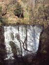
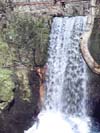
F At the head of the Glen is the Alva Dam. The falls may be viewed from the end of the path alongside the dam.
G Follow the Zig Zag Path to an iron seat for a superb view down the Glen.
H The Smugglers Cave. The burn flows through this huge cavern which can be viewed from a guard rail on the clifftop.
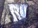
I The Spout of Craighorn and the falls of the Winnel Burn.
J Return along the shoulder of Torry and the Pate Road. Descend down through the eroded basalt rocks to the east end of the golf course and follow the path back to the car park.
